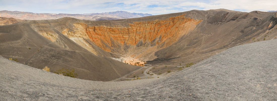
Ubehebe Crater, Death Valley

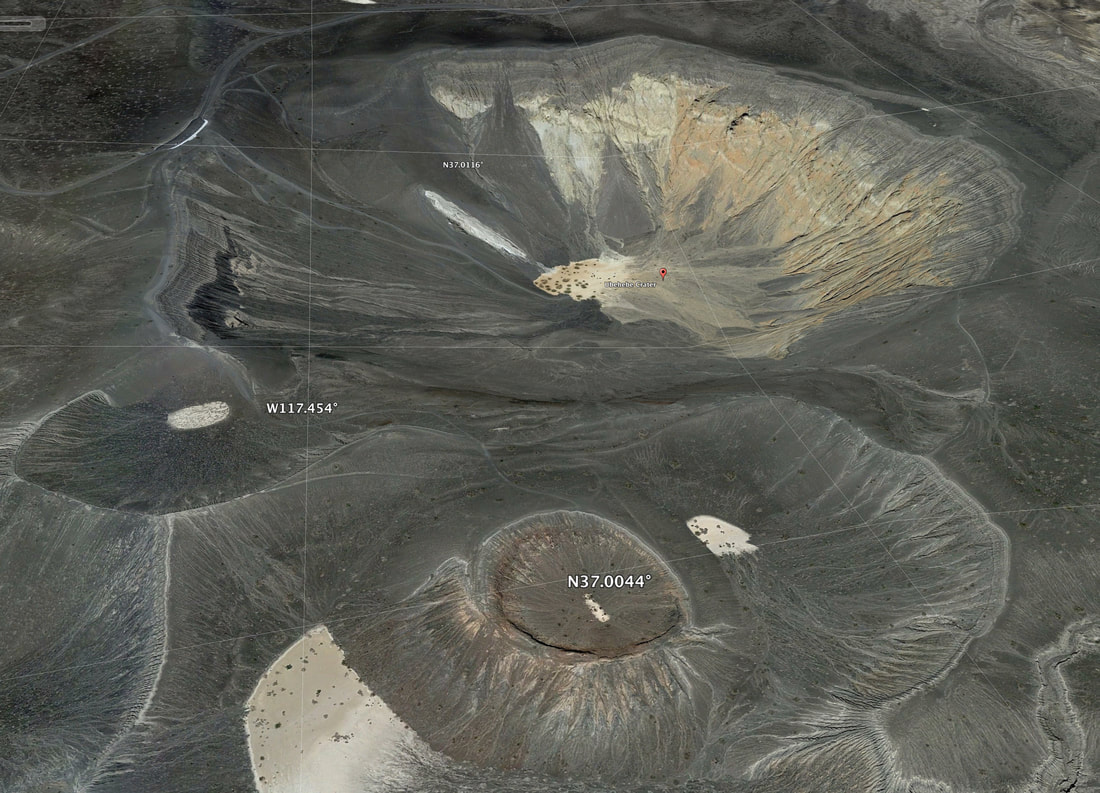
Image from Google Earth
By Elizabeth Saxton Henry (Own work) Attribution-ShareAlike 4.0 International via Wikimedia Commons
Resources:
|
Ubehebe Crater is a large volcanic crater in the northern half of Death Valley. Ubehebe Crater (pronounced YOO-bee-HEE-bee) is located at the north tip of the Cottonwood Mountains. The crater is half a mile wide and 500 to 777 feet deep. The age of the crater is estimated from 2,000 to 7,000 years old but maybe even as young as 800 years old.
The crater was formed when magma migrated close to the surface and the heat of the magma caused groundwater to flash into steam, throwing large quantities of pulverized old rock and new magma across the stony alluvial fan draped across the valley floor. The magma rose through a fault that lies along the western base of Tin Mountain. Movement on this fault was responsible for uplift of the entire Cottonwood Mountains range. The resulting large steam explosions are called a hydrovolcanic or phreatic eruption by geologists and the pits created are known as maars. Ubehebe was the last and largest in series of similar eruptions in the immediate area (its eruption exceeded the tensile strength of the bedrock by 10 times). Earlier eruptions created a group of much shallower maars to the south and another to the west. Little Hebe is a spatter cone that grew in the middle of one of the largest maars in the south group. All of the maar-forming eruptions sent out fallout debris that mantled a broad area around the volcanic field. The resulting light to dark gray cinder deposits consist of finely fragmented volcanic rock mixed with pulverized bedrock and are thickest immediately next to Ubehebe (80 feet). Gullies that were 15 to 20 foot deep dissected the area prior to the eruptions and were buried by the fallout. Erosion has since re-excavated these features, exposing layers of cinder that still overlay adjacent ridges.
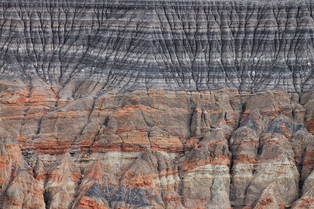
Miocene-aged mostly reddish orange-colored conglomerate makes up the exposed bedrock in Ubehebe's walls. These sediments were deposited by streams and contain limestone, mudstone, quartzite and volcanic cobbles that are up to 8 inches in diameter. There is also a difference in color between these seabed sediments: On the left, these sediments are yellowish in hue while on the right they are orange. The reason is due to a fault that separates the two different sedimentary units; over time at least 400 feet of vertical displacement along this fault has resulted in the abutment of these two different sedimentary units. There are three major trails at the crater. One trail goes from the parking area to the bottom of Ubehebe, a second circumnavigates the crater rim, while a third trail leads off to Little Hebe. Winds at the rim of Ubehebe are very strong and often gusts above 50 mph. This text taken in part from Ubehebe Crater by multiply authors and is licensed under Creative Commons Attribution-ShareAlike License |