• Home
  • Our Adventures
    • Death Valley >
      • Artist Drive, Death Valley
      • Badwater, Death Valley
      • Ballarat Ghost Town, Death Valley
      • Broken Pick mine, Death Valley
      • Charcoal Kilns, Death Valley
      • Charles Manson Hide Out Barker Ranch, Death Valley
      • Chloride Cliffs, Death Valley
      • Corona Mine, Death Valley
      • Crater Sulfur Mine, Death Valley
      • Devils Golf Course, Death Valley
      • Geologist Cabin, Death Valley
      • Harmony Borax works, Death Valley
      • Ibex Springs Talc Mine, Death Valley
      • Inyo Mine, Death Valley
      • Keane Wonder Mine, Death Valley
      • Keystone Mine, Death Valley
      • Lost Burro Mine, Death Valley
      • Marble Bath, Death Valley
      • Mesquite Flat Sand Dunes, Death Valley
      • Morning Glory Mine Camp, Death Valley
      • Racetrack, Death Valley
      • Rhyolite, Nevada
      • Russell Camp, Death Valley
      • Ryan, Death Valley
      • Scotty's Castle, Death Valley
      • Skidoo Ghost Town, Death Valley
      • Stella's - Mengel Cabin, Death Valley
      • Teakettle Junction, Death Valley
      • Titus Canyon, Death Valley
      • Ubehebe Crater, Death Valley
      • Warm Springs, Death Valley
      • Zabriskie Point, Death Valley
    • California Gold Country >
      • Alleghany, California
      • Big Springs, highway 49
      • Downieville, California
      • Forest City
      • Kenton Mine
      • Kentucky Mine and Museum
      • Love Falls Yuba River
      • Mountain House Henness Pass
      • Oregon Creek Covered Bridge
      • Poker Flat
      • Sierra Buttes Mine
      • Sierra City, Ca
      • Young America Mine
  • Story Blog
  • Our Company
  • Support
  Welcome to Backcountry Explorers

Crater Sulfur Mine


Crater Sulfur Mine, Death Valley

 GPS: 37.211856°, -117.688461°


Front view of Sulfur mine trommel
Front view of retort
Backside view of trommel
End view of retort
View looking down canyon from top of Sulfur Mine, Death Valley
Open pit of Sulfer Mine
The Crater Sulfur Mine area was discovered in 1917 and lies 48 miles east of Big Pine and five miles west of Death Valley’s north end in the Last Chance Range of Inyo County. The principal mineralization is along north trending faults extending three miles long by about a mile wide. This deposit is most likely the result of hot springs hydrogen sulfide gas reacting with gypsum, organic matter and carbonic acid. This was the largest sulfur deposit found west of the Mississippi River.
The start of real production came when in 1929 the Pacific Sulfur Company of New York began mining the six Crater claims. The town of Crater built to support the mine lasted only a few short years with and area population of only 36 folks. The town of Crater has since been torn down. In 1936-1937 Sulfur Diggers Inc. installed retorts and were able to ship 5,000 tons of 96% pure sulfur.
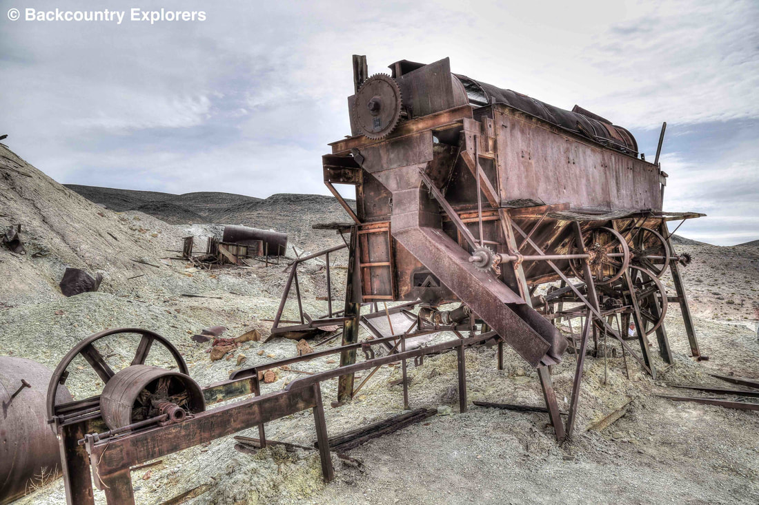
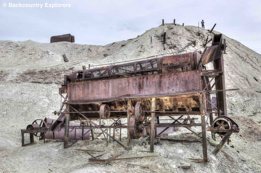
Later in 1938 the Western Mining Company added a 100-ton new retort and through the use of an open pit mine produce 10,000 tons of sulfur. At the time it took a 125 horsepower steam boiler for the retorts using over 3,000 gallons of water daily. Fifteen men worked the mine while a second fifteen worked the mill.
Many different owners and leasees have worked the claims over the years off and on. In 1953 a sulfur dust explosion temporarily shut down production when the mill was destroyed.
No real production has been reported since 1969 with total production of the Crater mine put at 58,000 tons of ore. As of 1984 it is estimated that there is still 3 million tons of 40% sulfur resources remaining at the Crater site.
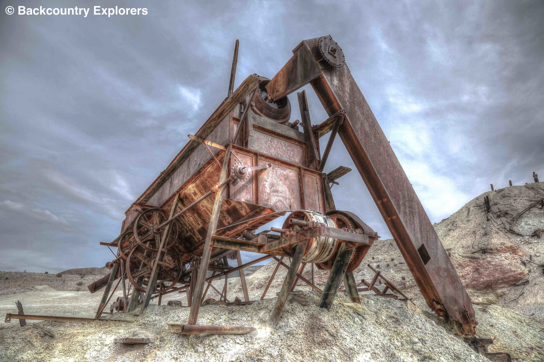
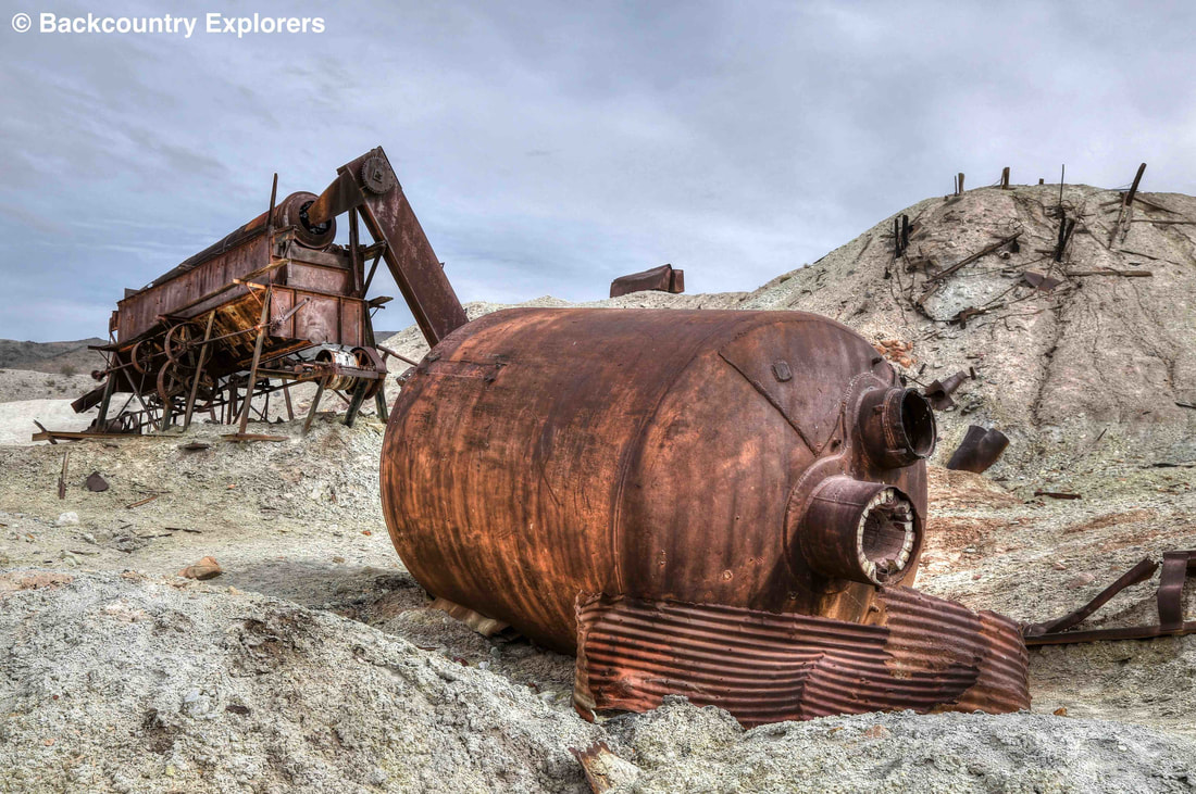
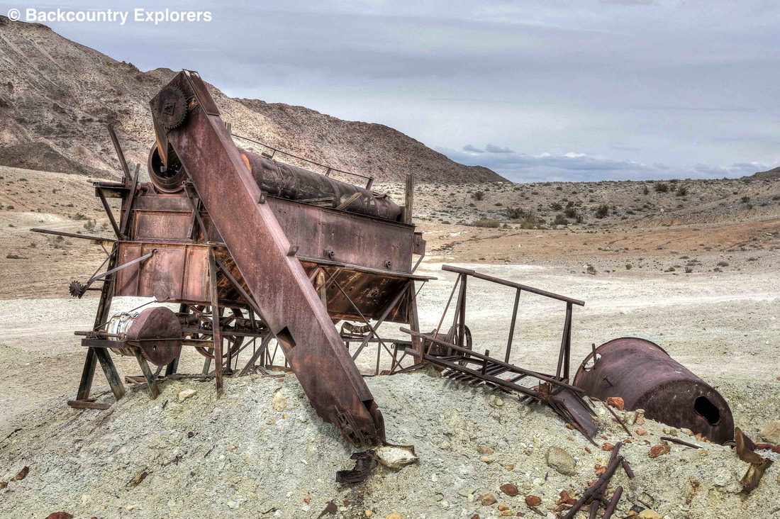
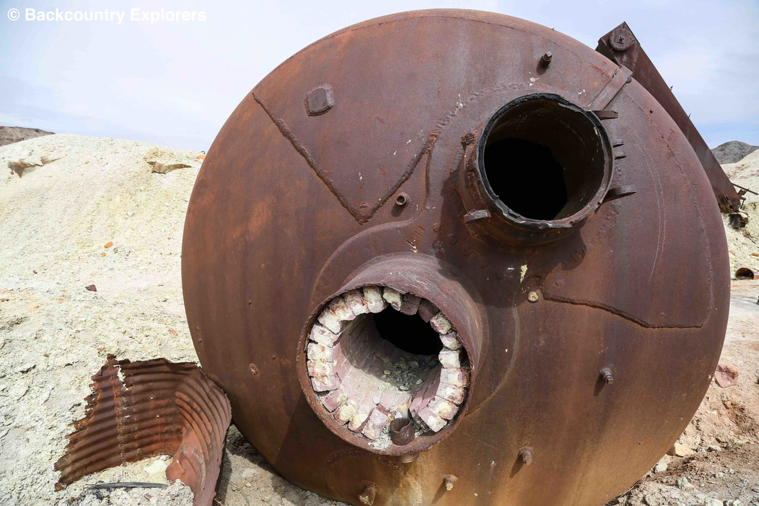
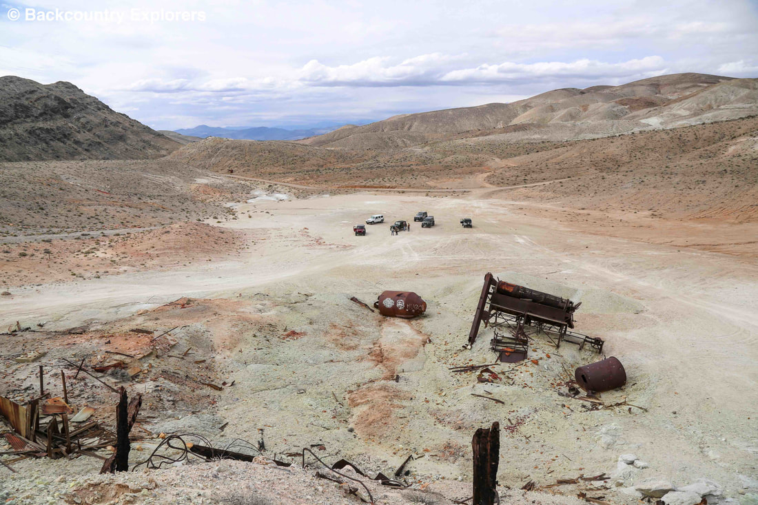
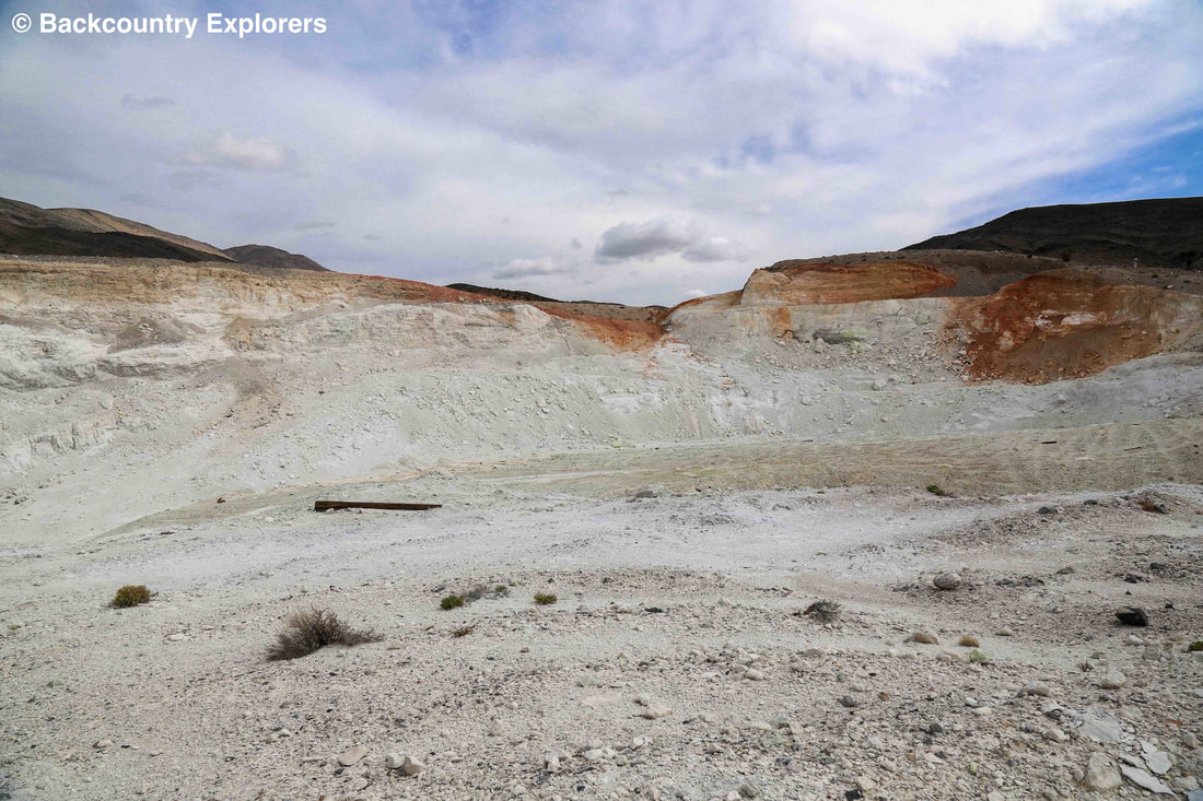
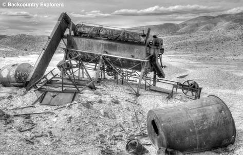
If you visit the Crater Mine today the pit was enlarged to 200 feet across by 500 feet wide by 50 to 60 feet deep. Remains of the old processing equipment lay scattered around the area. This mine lies outside of Death Valley National Park on patented private lands.
​

End view of trommel with belt wheel
Side view of Sulfur Mine trommel
Picture

Resources:

Death Valley National Park (National Geographic Trails Illustrated Map)


Exploration

Death Valley
Gold Country

Eastern Sierras / 395
Anza Borrego
Route 66
Western Mojave Desert
Mojave National Preserve
Arizona
Colorado
Utah
Nevada

Our Company

About us
Contact us

Support

Site Map
Links
FAQ
Terms of Use
Copyright  ©  2015  Laymon International LLC   21143 Hawthorne Blvd. #418 Torrance, Ca 90503 
  • Home
  • Our Adventures
    • Death Valley >
      • Artist Drive, Death Valley
      • Badwater, Death Valley
      • Ballarat Ghost Town, Death Valley
      • Broken Pick mine, Death Valley
      • Charcoal Kilns, Death Valley
      • Charles Manson Hide Out Barker Ranch, Death Valley
      • Chloride Cliffs, Death Valley
      • Corona Mine, Death Valley
      • Crater Sulfur Mine, Death Valley
      • Devils Golf Course, Death Valley
      • Geologist Cabin, Death Valley
      • Harmony Borax works, Death Valley
      • Ibex Springs Talc Mine, Death Valley
      • Inyo Mine, Death Valley
      • Keane Wonder Mine, Death Valley
      • Keystone Mine, Death Valley
      • Lost Burro Mine, Death Valley
      • Marble Bath, Death Valley
      • Mesquite Flat Sand Dunes, Death Valley
      • Morning Glory Mine Camp, Death Valley
      • Racetrack, Death Valley
      • Rhyolite, Nevada
      • Russell Camp, Death Valley
      • Ryan, Death Valley
      • Scotty's Castle, Death Valley
      • Skidoo Ghost Town, Death Valley
      • Stella's - Mengel Cabin, Death Valley
      • Teakettle Junction, Death Valley
      • Titus Canyon, Death Valley
      • Ubehebe Crater, Death Valley
      • Warm Springs, Death Valley
      • Zabriskie Point, Death Valley
    • California Gold Country >
      • Alleghany, California
      • Big Springs, highway 49
      • Downieville, California
      • Forest City
      • Kenton Mine
      • Kentucky Mine and Museum
      • Love Falls Yuba River
      • Mountain House Henness Pass
      • Oregon Creek Covered Bridge
      • Poker Flat
      • Sierra Buttes Mine
      • Sierra City, Ca
      • Young America Mine
  • Story Blog
  • Our Company
  • Support